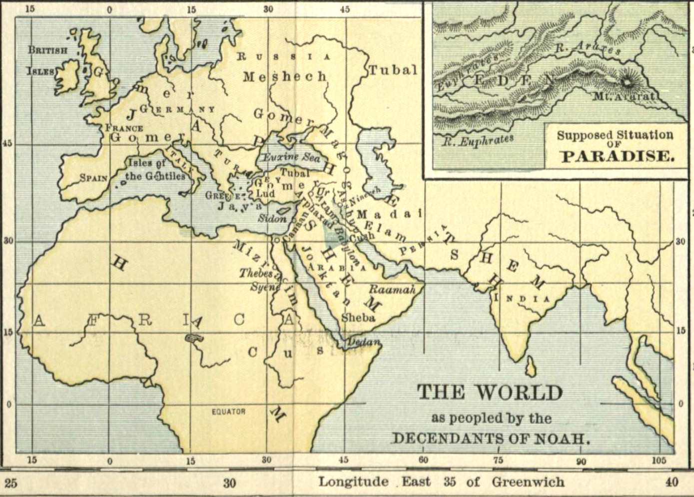
This won't come as any surprise to anyone who has ever been to Muş, but according to one early 20th century map, it's the location of the Garden of Eden. Locating paradise led to a lot of
fun maps back in the day (and
now). The biblical clues run as follows:
"A river flowed out of Eden to water the garden,
and there it divided and became four rivers. The name of the first is
the Pishon. It is the one that flowed around the whole land of Havilah,
where there is gold. And the gold of that land is good; bdellium and
onyx stone are there. The name of the second river is the Gihon. It is
the one that flowed around the whole land of Cush. And the name of the
third river is the Tigris, which flows east of Assyria. And the fourth
river is the Euphrates."

Based on this description, at least, Eastern Anatolia, near the origins of the Tigris and Euphrates rivers, seems about as good a guess as any. I don't know much about the larger map, showing the world as peopled by the descendants of Noah. The children of Japhet are in Europe, the children of Ham, or Hamites, are in Africa, and the children of Shem, or Semites, are in the Middle East. The people of Magog are still spread across the Caucasus, before legend has it that Alexander the Great built an iron wall in order to
safely contain them north of the mountain range. The miniature left, showing the building of the wall, comes from a 16th century illustration of the Falname.


